
Wednesday, October 17, 2012


Monday, October 15, 2012

Field Research: Fort Ord
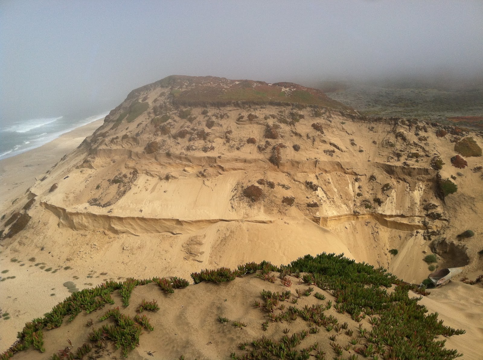
Day 2: We worked with four individuals from California State -East Bay and used Ground Penetrating Radar (GPR), shown below, to image the dune substrate (above photo). GPR works by sending FM radio waves into the earth and measuring their reflections.

Our study area was the Fort Ord Dunes, a decommissioned military base. We ran one 200m transect from a bunker in the south west area of the dunes to the north east (below photo). This transect ran across a number of old military bunkers which will be interesting to see how they influence our results. It was perfect weather and we learned a ton!

Sunday, October 14, 2012

the dunes at monterey
After a delicious breakfast of eggs toast coffee and muffins the geography 368 team is ready to do some stunning research along the coast! Using gpr systems the class will analyze of the internal stratigraphy of the coastal dunes! The study site is located on an old military field so who knows what awaits tbe class!
Day 1 Recap
Day 1 began at 7:30 yesterday morning. Our morning consisted of organizing and travel logistics. Arriving the previous evening, I was pleasantly surprised to find mountains in eyesight of the hotel when we road-tripped to the local grocery store! We picked up a variety of food and snacks to keep ourselves plenty satisfied and stopped for lunch at an In and Out Burger, a "first" for a majority of us. A fed and watered group makes for a happy trip!


We made our way up Hwy 10 to 210 to 5 to 166. There was a major transition in land use from the end of Highway 55 and 166. We entered the valley and a citrus agriculture hub. From there we ended up at a salt pan straddling the Andreas Fault. And yes, the salt really tastes like salt. Ask Roy or Arik! The Andreas fault is a strike slip fault. This means that the sides of the fault are moving in opposite directions. The fault slices directly through this valley. Throughout this drive we observed houses on ridges and pipelines from mountain to mountain. In the instance of a massive earthquake, the landscape would change dramatically and the people in the area would be greatly affected.
After leaving this area, Martin's keen eye discovered a tarantula making its way along Soda Lake Road. The picture is below.
We continued north to Morro Bay where we encountered our first sand dunes and got to play in the ocean. Arik briefed us on Morro Rock which was previously a volcano that cone solidified creating a sort of plug. We also witness the changing of the wind due to the land cooling down and the sun sucking air from shore. We had dinner on the beach and arrived at the hotel at 10pm. I was a little tired - hence why this is posted today! But I am having a blast, discovering a region of the US that I have not been exposed to! Take care family and friends!
Subscribe to:
Posts (Atom)